
1. Background
With the continuous promotion of highway construction and the rapid increase in the number of motor vehicles in China, the physical health of highway engineering has become a core factor affecting road disaster prevention and loss control. Especially in areas with high traffic flow, the long-term use and aging of infrastructure such as roads, bridges, and tunnels directly affect driving safety, traffic efficiency, and accident prevention. Therefore, conducting comprehensive health assessments, identifying hidden dangers, and maintaining and reinforcing facilities in a timely manner for these engineering entities is of great significance for preventing traffic accidents, improving road safety, and reducing potential disaster risks.
2. Sky ground integrated technology empowers risk reduction
In this context, MINTAIAN has innovatively launched a technology service plan for reducing highway risks, with "remote sensing+big data+Internet of Things+digital twin+AI" as the core technology. By building a four-dimensional prevention and control system of "sky observation, aerial photography, ground patrol, and model calculation", it achieves intelligent identification, precise warning, and systematic governance of road safety hazards.
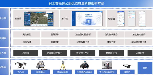
3. Core application scenario: Full chain risk prevention and control
● Geographic and Natural Risk Analysis
Using geographic information technology, MINTAIAN obtains and analyzes regional key indicators through the geographic time-space risk database, analyzes the indicators of nine disaster data, including earthquake, flood, typhoon, drought, high temperature, low temperature, strong wind, snow disaster and rainstorm, conducts natural disaster risk assessment, and forms a risk distribution map by topic to guide disaster prevention and reduction.
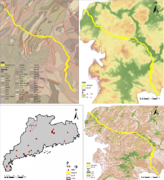
● Hidden danger investigation of main road engineering
Risk data collection: Utilize satellite remote sensing and drone aerial photography to obtain image data of the main projects along the highway, and generate high-precision 3D models; And cooperate with offline experts to conduct on-site inspections and obtain comprehensive risk data.
Risk and hazard analysis: Import data into a visual analysis platform for analysis, supporting the identification of various visual risk features, including road cracks, isolated rocks on slopes, and blockages in drainage ditches. It can also support the comparison of periodic laser point cloud data/InSAR data to analyze ground subsidence.
Analysis of Bridge and Tunnel Damage
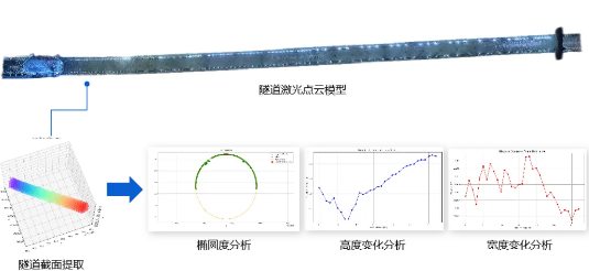
Inside the tunnel: Handheld/gantry laser point cloud equipment is used to perform laser scanning on the target and obtain periodic laser point cloud data. Extract the cross-sectional profile of the tunnel in the algorithm platform, perform periodic data multi period comparison, evaluate ovality, height variation, and width variation at half height to identify lining thickness deviation and contour anomalies.
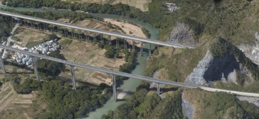
Bridge facilities: Unmanned aerial vehicle mounted laser point cloud equipment is used to conduct full coverage scanning of bridges, obtain high-precision point cloud data, and generate models to identify hidden dangers such as bridge cracks and structural aging. Periodic data is compared over multiple periods to detect potential risks caused by deformation and displacement.
Analysis of Underground Hazards in Roadbeds
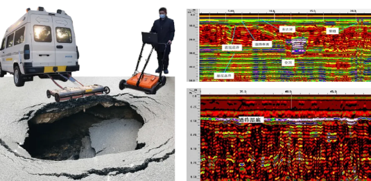
Data collection and processing: Ground penetrating radar is used to detect the surrounding ground of high-risk building areas, collect underground electromagnetic wave reflection data, and generate underground structure distribution maps using professional software; Compare historical data to extract geometric shape, depth, and range information of underground anomalous areas.
Risk identification: Analyze underground pipeline damage, soil loosening, voids, and other structural hazards to form a detailed risk analysis report.
● Highway wind survey system
Integrate the collected multi-source data into the digital twin platform, supporting multi-dimensional and multi tool calculation and analysis.
Visual risk assessment: Visual risk assessment and annotation of ground facilities in ground imagery or digital twin models.
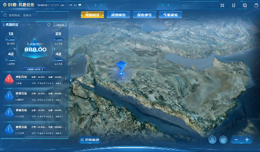
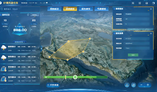
Flood risk simulation analysis: Combining digital twin models, using flood simulation tools to simulate and predict waterlogging and flood distribution under extreme weather conditions, generate risk distribution maps, and clarify high-risk areas and potential disaster areas.
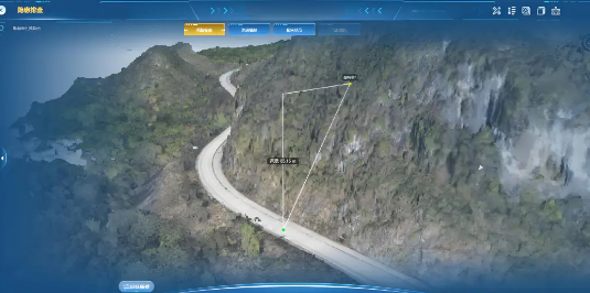
Terrain measurement and analysis: Based on a 1:1 ratio of actual construction projects, road conditions are measured and analyzed, such as distance measurement, terrain area measurement, height measurement, volume measurement, etc., to assist experts and appraisers in making judgments.
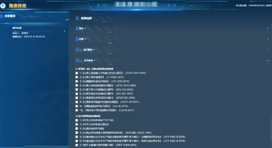
Automatic generation of risk investigation report: Combining the results of periodic technical service work, including reading natural disaster risk data from the risk database, AI visual analysis of hidden dangers, comparison of data collection cycles, expert annotation of key risks and evaluation of key indicators, the system supports automatic generation of risk investigation report.
4. Solution value: Technology driven security upgrade
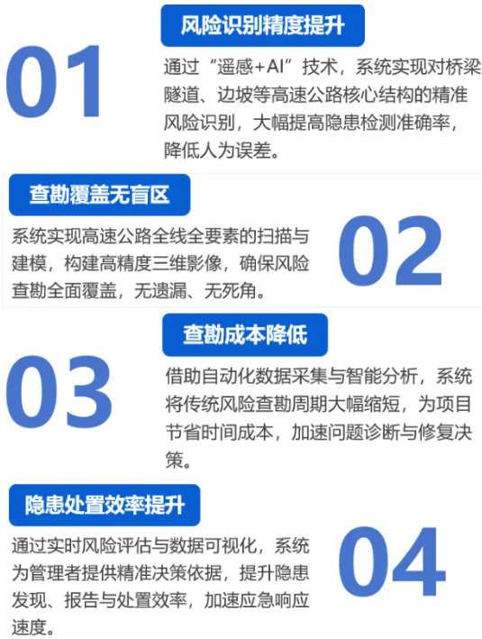
In the new stage of intelligent transportation moving towards "all factor digital reconstruction", the technology service plan for risk reduction throughout the life cycle of the MINTAIAN Expressway is built with a technology cluster of "remote sensing+big data+Internet of Things+digital twin+AI" to construct a "digital immune system" for infrastructure risks. Through the three-dimensional perception network, MINTAIAN has upgraded the traditional post disaster emergency mode to an active defense system with "calculable risks, predictable hidden dangers, and closed-loop disposal". This not only echoes the requirements of the national "transportation power" strategy for improving infrastructure resilience, but also injects "digital vitality" into the 140000 kilometer road network with the power of technology, making every road a smart defense line to safeguard people's safe travel.
 WeChat official account
 WeCom
WeCom