
On March 1, 2025, in order to improve the efficiency and technological level of MINTAIAN operations, MINTAIAN Technology Information Business Department recently organized a practical teaching and training session with the theme of "Unmanned Aerial Vehicle Inspection Field Operations" in Xianning City, Hubei Province. This training focuses on the entire process of drone operation and the practical application of infrared thermal imaging technology. Through a combination of "theory+practice", it helps the appraisal team master cutting-edge technical tools and injects intelligent energy into fields such as insurance survey and disaster loss assessment.
On site teaching: three core modules to solidify skills
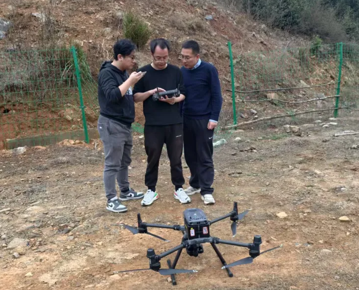
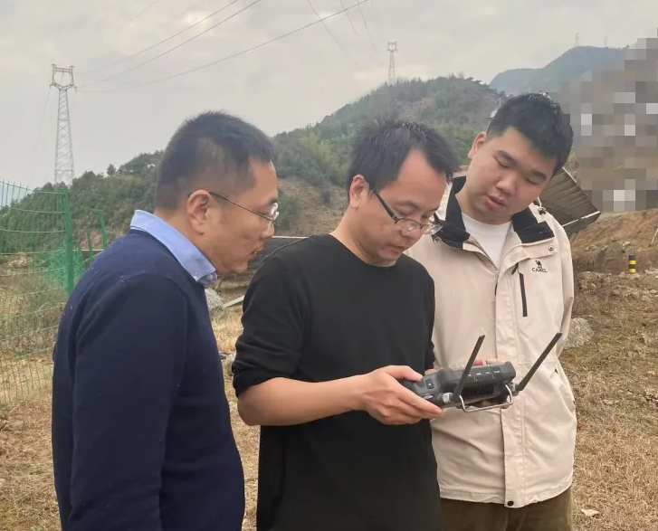
During the 2-day training, Long Da, a drone pilot instructor from the Information Business Department of MINTAIAN Technology, conducted systematic teaching on the practical application of drones in appraisal scenarios
1. Standardize takeoff and landing and safety operations: From equipment assembly, environmental inspection to emergency response, trainees repeatedly practice in simulated complex terrain to ensure operational safety;
2. Practical intelligent route planning: Combining DJIpilot2 ground station system, demonstrate how to efficiently plan routes through professional software and achieve precise coverage of large areas;
3. Precautions for the entire flight process: Focus on explaining key aspects such as adjusting routes based on terrain conditions, avoiding high-voltage towers, and saving flight data.
Technology Empowered Assessment: Dual Improvement of Efficiency and Accuracy
The lecturer of this training, Long Da, stated that "traditional surveying is limited by manpower and terrain, while drones equipped with infrared equipment can complete aerial photography and heat source scanning of an area of 200000 square meters in 20 minutes. Taking the inspection project of a photovoltaic power station in Xianning City, Hubei Province as an example, the drone team quickly identified hidden fire points through hot spot data, timely warned of the risk of secondary accidents, and helped customers reduce potential losses of millions of yuan.
Student feedback: Dual breakthrough from theory to practice
Wang Kang from the Henan branch and Shi Yuan from the Zhejiang branch, who participated in the training, said, "In the past, the analysis of infrared images relied on experience. After learning the AI assisted diagnostic system this time, the accuracy of anomaly recognition has significantly improved. In the future, we will be able to more efficiently complete large-scale survey tasks at disaster sites such as typhoons and hail. ”
Regarding the future: Building a "drone+AI" survey ecosystem
The Information Business Department of MINTAIAN Technology plans to incorporate drone technology training into the regular assessment system and expand the application depth of drone technology in agricultural insurance, engineering insurance and other fields, continuously promoting the digital transformation of the insurance appraisal industry.
 WeChat official account
 WeCom
WeCom