
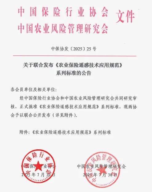
China's agricultural insurance has achieved a historic breakthrough! On July 30, 2025, the series of standards for the application of agricultural insurance remote sensing technology jointly formulated by the China Insurance Industry Association and the China Agricultural Risk Management Research Association were officially released. This standard establishes for the first time unified remote sensing application technology guidelines for the four core crops of rice, wheat, corn, and cotton, marking the official entry of China's agricultural insurance into a new era of "precision, intelligence, and standardization".
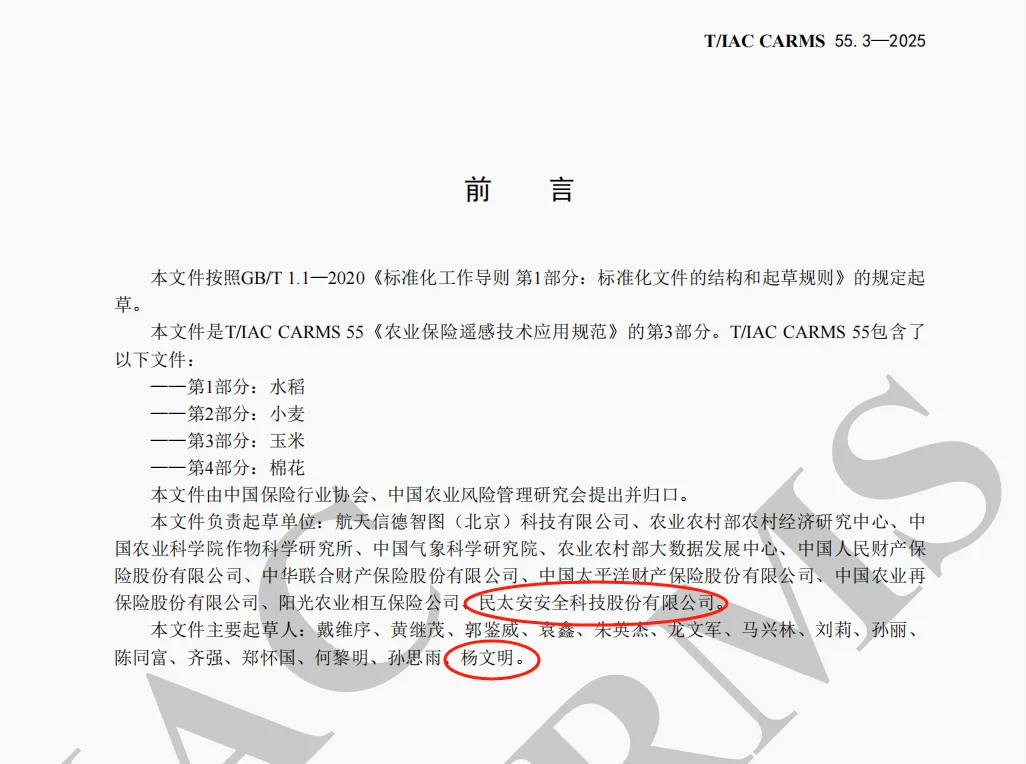
As a core participating unit, MINTAIAN Safety Technology Co., Ltd. (hereinafter referred to as "MINTAIAN") has been deeply involved in the drafting of the third part of the "Specification" - the application specification for remote sensing technology of corn crops, and has contributed key strength to filling the gap in remote sensing technology for corn insurance in China!
From "Experience Estimation" to "Technological Quantity": Four Years, Ending Achievements
For a long time, agricultural insurance loss assessment has mainly relied on manual inspections, which are inefficient, costly, subjective, and prone to causing claims disputes. The series of standards released this time have gathered the joint research and development wisdom of more than 30 top institutions, including MINTAIAN, over the past four years. They have completely changed the vague situation of agricultural insurance's "experience based loss assessment" and provided the industry with a scientific, objective, and efficient "technical standard".
MINTAIAN Contribution: Tackling Corn Remote Sensing and Defining Technological Benchmarks
In the formulation of this standard, MINTAIAN, with its profound accumulation and leading practice in the field of agricultural insurance technology, especially in the risk assessment and loss assessment of corn crops, undertook the core drafting task of the corn standard. Our expert team has been deeply involved, deeply integrating cutting-edge remote sensing technology with corn planting characteristics and disaster laws, successfully overcoming multiple technical difficulties, and significantly improving the accuracy and efficiency of corn insurance loss assessment.
Expert in Data Fusion Strategy: In response to the characteristics of tall corn plants, dense canopy, and susceptibility to drought, flood, and lodging, the MINTAIAN team has accurately defined a high-resolution (better than 10 meters) satellite remote sensing and unmanned aerial vehicle (UAV) collaborative observation scheme suitable for corn insurance, which solves the core pain point of "unclear and impenetrable" tall crops and ensures the comprehensiveness and detail capture ability of data acquisition.
Builder of growth monitoring indicators: Based on the unique growth stages of corn, such as jointing stage, tasseling and silk emergence stage, and grain filling maturity stage, MINTAIAN led the development of a quantitative monitoring system for corn growth that covers more than ten key indicators. Innovatively applying remote sensing technologies such as NDVI and specific spectral bands to achieve precise identification and dynamic assessment of maize seedling conditions, nutritional status, drought stress, and lodging risks, making the "good growth" no longer ambiguous.
Leader of intelligent loss assessment models: In response to the vulnerability of corn to disasters such as drought, floods, wind and hail (lodging), MINTAIAN has developed and contributed an intelligent loss assessment model based on "multispectral/hyperspectral analysis+machine learning algorithm". This model strictly controls the error rate of corn disaster loss assessment within 5%, and improves the efficiency of loss assessment by more than three times compared to traditional manual methods, laying a solid technical foundation for fast and fair claims settlement. This is not only a breakthrough in standards, but also a strong proof of MINTAIAN's core competitiveness in the field of corn insurance technology.
Standard implementation, win-win situation for all parties: technology empowers the new ecology of agricultural insurance
The four major crops of rice, wheat, corn, and cotton account for over 60% of the country's crop planting area and are the cornerstone of national food security and important agricultural product supply. The release and implementation of this standard will have a profound impact.
1、 Farmers benefit. After the disaster, the assessment period has been significantly shortened to within 48 hours, and the speed of receiving compensation is expected to increase by 50%, effectively ensuring the income of farmers, helping to restore production after the disaster, and allowing farmers to take the reassurance pill of "settling claims with peace of mind".
2、 Insurance companies increase efficiency. The standardized technical process significantly reduces operating costs, and the objective analysis based on remote sensing data enhances the ability to identify fraud risks for the four major crops. The risk of insurance fraud is effectively reduced by more than 60%, improving the industry's risk management level and service efficiency.
3、 National security upgrade. To safeguard national food security and ensure stable supply of important agricultural products, a strong "technological barrier" has been added, ensuring that the policies of strengthening agriculture and benefiting agriculture are more precise and efficient in reaching the fields, enhancing agricultural risk resilience and modernization level.
MINTAIAN: With the power of technology, safeguard the granary of a great country
Participating in and leading the development of national standards for agricultural insurance remote sensing in the corn sector is an important milestone for MINTAIAN to continue to deepen its cultivation of agricultural insurance technology and fulfill its social responsibility. This is not only an authoritative recognition of our company's technical strength and industry status, but also reflects our firm determination to use innovative technology to serve agriculture, rural areas, and farmers, and ensure national food security.
In the future, MINTAIAN will continue to leverage its leading advantages in agricultural insurance technology, especially in remote sensing, big data, and artificial intelligence applications. It will actively participate in the construction and optimization of industry standards, promote the transformation and implementation of technological innovation achievements, and contribute to the construction of a more accurate, efficient, and inclusive modern agricultural insurance service system with the "MINTAIAN Wisdom" and "MINTAIAN Solution". It will move forward courageously on the road of empowering the construction of a strong agricultural country with technology!
Regarding MINTAIAN:
MINTAIAN Safety Technology Co., Ltd. (listed on the New Third Board, stock code: 833984), founded in 2005, is headquartered in Shenzhen and has 35 branches nationwide with a registered capital of RMB 170 million. The company is a national high-tech enterprise, an innovative small and medium-sized enterprise in Shenzhen, a specialized and innovative small and medium-sized enterprise in Shenzhen, and has been rated as an AAA credit enterprise. We have obtained multiple authoritative certifications, including ISO9001 Quality Management System, ISO27001 Information Security Management System, and ISO45001 Occupational Health and Safety Management System.
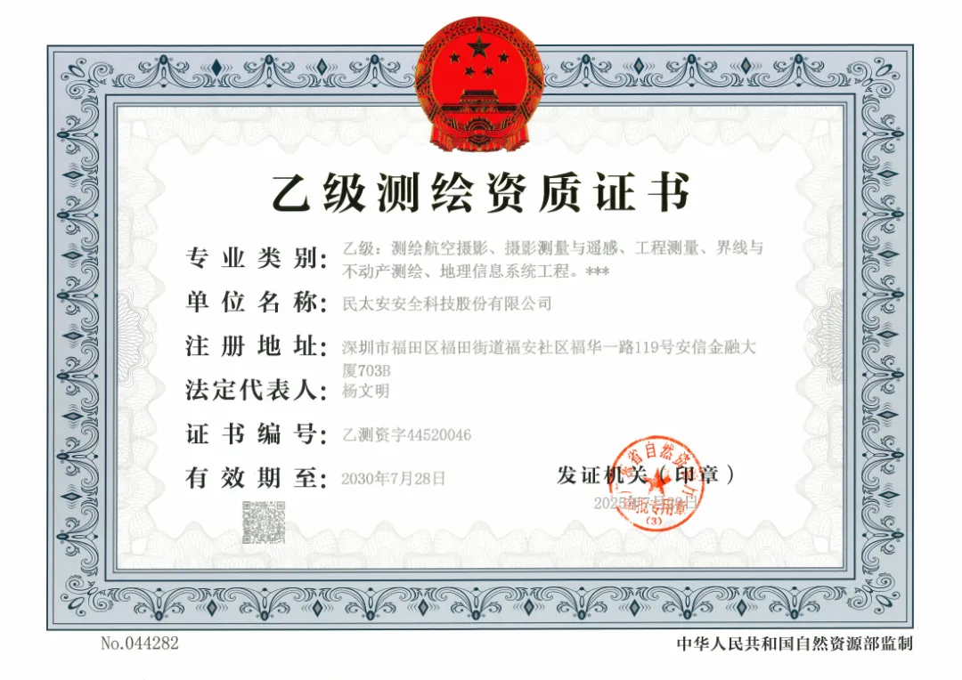
Deeply cultivating the field of insurance valuation, MINTAIAN adheres to a development strategy driven by both professional operation and technological empowerment. Relying on strong spatial geographic information technology capabilities, the company holds professional qualifications covering surveying and mapping aerial photography, photogrammetry and remote sensing, engineering surveying, boundary and real estate surveying, geographic information system engineering, and other fields. This enables us to:
Accurately obtaining multidimensional data: Utilizing advanced aviation equipment for surveying and aerial photography, providing high-precision geographic data foundation for resource investigation, environmental monitoring, and spatial information management of insurance targets.
Efficient parsing of spatial information: By utilizing photogrammetry and remote sensing technology, rapid acquisition, processing, and analysis of large-scale surface information can be achieved, enabling dynamic monitoring and efficient updating of geographic information.
Deeply empowering core business: The professional capabilities of engineering surveying, boundary and real estate mapping, and geographic information system engineering are deeply applied to the core aspects of accurate loss assessment, risk assessment, disaster prevention and loss reduction, and claims support in insurance valuation, especially in complex scenarios such as agricultural insurance and engineering insurance, providing solid spatial data support and professional technical support for objective, fair, and efficient valuation services.
Since its establishment, the company has adhered to the corporate mission of "serving the people's peace and health", adhered to the corporate philosophy of "professionalism, innovation, technology, coordination, and sharing", and continuously improved service efficiency through technological innovation. With leading applications and profound accumulation in insurance technology, especially in remote sensing, big data, artificial intelligence and other fields, MINTAIAN has created an excellent brand image of professional first-class, reliable reputation, and efficient service, committed to becoming a trustworthy technology-based risk management and assessment service expert in the safety emergency and insurance industry chain.
 WeChat official account
 WeCom
WeCom