
On July 4th, the Information Business Department of MINTAIAN Technology, together with a drone team, assisted a branch company in conducting a forest fire assessment and survey operation in a certain county.
The insured reported a loss area of 1500 acres this time. After discussion, the Kexin team decided to adopt a full process solution of drone+LiDAR+AI, using LiDAR to scan the burnt forest and form a high-precision 3D laser point cloud model. Through scientific and professional software, accurate forest burning area, burn area, and exposed mountain area were calculated. AI technology was used to identify the number of trees in the burned area, and the data was handed over to the appraiser to assist in completing the appraisal report.
When collecting data through drone operations, the client, claims personnel, and staff from the Fire Prevention Office of the Forestry and Grassland Bureau where the insured is located highly affirmed and praised the professional level of the survey conducted by MINTAIAN Technology.
While assisting the appraiser in completing the survey work, the MINTAIAN Kexin team analyzed the collected data and completed the training of AI forest recognition algorithm. Next, the team will integrate remote sensing images to generate DSM and DEM, analyze forestry indicators such as biomass, accumulation, canopy height, canopy coverage, canopy closure/gap ratio, forest window parameters, and tree density within the forest, and accumulate data and technical experience for different survey needs in the future.
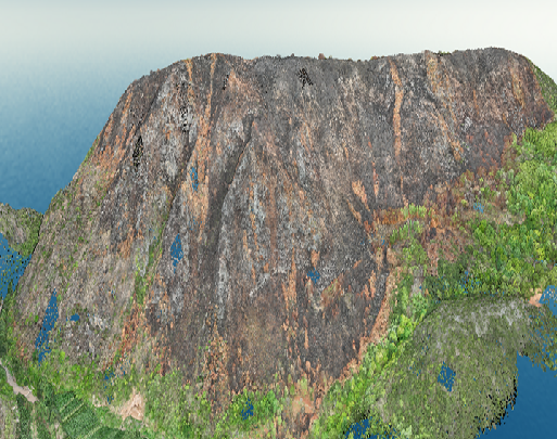
3D laser point cloud model
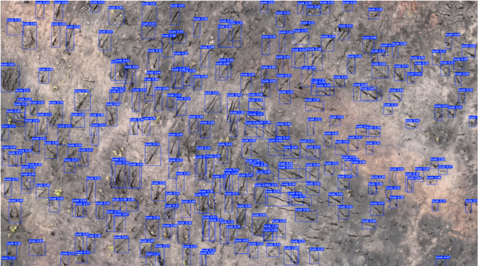
AI extracts burnt trees
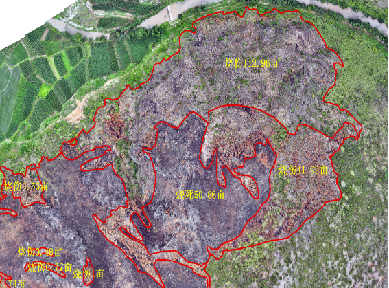
Segmentation and extraction of damaged forest areas
 WeChat official account
 WeCom
WeCom